Department of Public Works

Shoshone County Public Works is committed to serving the residents and visitors of our county to the best of our resources and abilities, and to maintain a safe and reliable road system.
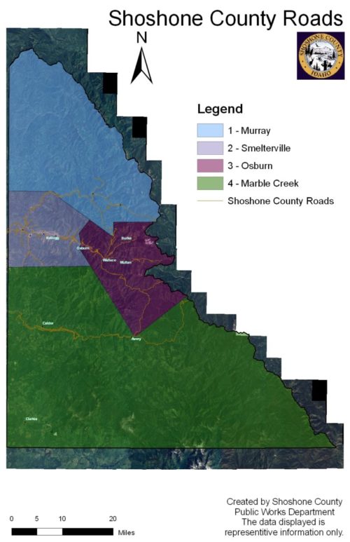
The Shoshone County Public Works Road & Bridge Department is responsible for the maintenance of approximately 377 miles of county roads. These roads are further broken down into the following surfaces
362+ total road miles
208.24 Hot Mix
106.53 Gravel Graded and Drained
35.56 Road or Cold Plant Mix
5.90 Asphalt Less Than 1”
4.85 Earth Graded and Drained
1.15 Unimproved
We operate four road districts, two county parks (Gene Day & W. Shoshone), and a snowmobile parking lot.
Moon Pass – We open Moon Pass in the Spring as weather and snow levels permit. Moon Pass is closed during the winter. We do not plow or maintain Moon Pass during the winter months.
Thompson Pass – We plow Thompson Pass until the 1 st Monday following Thanksgiving and reopen the pass as weather and snow levels permit in the spring.
Office Location:
700 Bank Street, Suite 35
Wallace, ID 83873
Office Hours:
Monday – Thursday* 9:00am – 5:00pm
Friday* 9:00am – 1:00pm
Phone:
(208) 753-5475
District Map
Helpful Links

Information Booth
Public Works Projects - 2018
The Shoshone County Road Department will have a very busy construction schedule this year.
Construction Projects in 2018 include:
Pine Creek Road .59 miles
Nine Mile Road .98
Dairy Road .31
Silver Valley Road .89 Between Reinoehl Road and Pinehurst City Limits
Big Creek Road 2.43
We will do our best to limit any inconvenience during our paving projects. We appreciate your
patience and understanding.
Public Works Projects - 2015
Box Paved Road Projects: Grubich Road and Weir Gulch Road Basin
Paved Road Projects: Silver Valley Road – Silverton to Mullan Avenue Enaville Bridge: Construction of new bridge just south of Snakepit Estimated time line – April through November 2015 and 2016
Yellowstone Pipe Line: North Fork of Coeur d’Alene River Replace pavement Mile Marker 3 through 11 Estimated time line – May 2015
Silverton Project: Re-route water to reduce flooding in east Silverton Estimated time line – Please contact the Coeur d’Alene Trust with any questions 783-0222
Graham Creek Culvert: Replace pavement Mile Marker 15 Estimated time line – May 2015
Deer Lane, Elk Creek Repair street pavement – Regrinds and seal coat
Bear Creek Road, Bear Creek Repair road – Inlay with regrinds and seal coat
Old Coeur d’Alene River Road Road Maintenance – Inlay with regrinds and seal coat. Replace signage.
Road Weight Limits
In accordance with Section 49-1005, Idaho Code, the County of Shoshone’s Department of Public Works, charged with the maintence of county roadways, has the authority to reduce the permissible sizes, weights, or speeds of vehicles operating on its road system for any periods as may be necessary for the protection of its roads or for public safety.
Purpose
Road weight limits and speed limits are designed to ensure public safety and to prevent structural damage to Shoshone County roadways resulting from the operation of heavy vehicles in changing climatic conditions.
Load Restrictions
During winter months, the moisture found in the soils and gravels below a road’s surface freezes. The depth of this frost zone varies depending upon the length and severity of the winter season. This frozon zone begins to thaw from the surface down, at varying rates. The moisture released by the thawing soils and gravels is trapped near the surface between the pavement and frozen soil below. When this occurs, the overhead passage of heavy equipment can create a “bouncing” or “pumping” effect on the trapped moisture layer, and can severely damage the roadway’s structural integrity and significantly decrease its lifespan.
Spring breakup restrictions are weather dependent – not calendar based. Such restrictions are normally required throughout the spring breakup season that can start as early as February and extend into May.
Types of Load Restrictions
Depending upon the type of road construction, the amount of moisture, temperature conditions and the severity of frost heaves and breakup, roads or sections of roads, the following restrictions will be posted in order to protect the roadway and to ensure public safety.
- Maximum of 10,000 pounds on steering axle (9 inch minimum tire width)
- Maxium of 300 pounds per inch of tire – all other axles
- 25 mile per hour speed limit
The load bearing capacity of a county’s roadway may be temporarily restored by a freeze-up of the pavement after a section has been posted for load and speed restrictions. Typically, during cold weather snaps, trucks and heavy equipment may be granted access to roadways in Shoshone County after temperatures have dripped to 20 degrees Fahrenheit for three successive nights. The County will post green markers on road weight limit signs to signify the temporary waiver of spring break-up restrictions.
Speed Restriction
Streets and roadways within the county are restricted as posted.
CDA Rails to Trails (Shoshone County)
Shoshone County maintains the following bike path crossings
- Frontage Road crossing west of Wallace
- Silver Valley Road @ Lake Gulch
- Gene Day Park access west of Osburn
- Big Creek Road crossing
- Golf Course Road crossing
- Elizabeth Park Road crossing
- Smelterville crossing (east end)
- Smelterville crossing @ “K” Street
- Enaville (FH-9) crossing @Snake Pit
Shoshone County Levees
(Full reports are on file at our office: 700 Bank Street, Wallace, ID. Public Works Department)
Pine Creek Levee Segment 1
- CURRENT RATING: MINIMALLY ACCEPTABLEPREVIOUS RATING: MINIMALLY ACCEPTABLE – May 2007
- The Pine Creek Levee Segment 1 was inspected on 10 August 2011 by the following personnel:
- Tyler Quick – COE, Geotechnical Branch
- Brian Stenehjem, COE, Geotechnical Branch
- Michael Gonia – COE, Geotechnical Branch
- Travis Gross – COE, Geotechnical Branch
- John Specht – Shoshone County, Emergency Manager
The local sponsor of Pine Creek Levee Segment 1 is Shoshone County. John Specht, emergency management director for Shoshone County, was present during the levee inspection. Pine Creek Levee Segment 1 is located along the right bank of Pine Creek from River Mile (RM) 7.4 to RM 5.5 and is approximately 11,300 linear feet. To reach the upstream end of the levee, take I-90 east and exit at Pinehurst. Take a right onto Division, and continue approximately 6 miles. Take a right on West Fork Pine Creek Road. Take a left at the fork in the road and follow West Fork Pine Creek Road to Melissy Bridge and levee on right. The team walked the levee beginning at the upstream end.
- The Pine Creek Levee Segment 1 was inspected on 10 August 2011 by the following personnel:
Pine Creek Levee Segment 2.
- CURRENT RATING: MINIMALLY ACCEPTABLEPREVIOUS RATING: MINIMALLY ACCEPTABLE – May 2007
- The Pine Creek Levee Segment 2 was inspected on 10 August 2011 by the following personnel:
- Tyler Quick – COE, Geotechnical Branch
- Brian Stenehjem, COE, Geotechnical Branch
- Michael Gonia – COE, Geotechnical Branch
- Travis Gross – COE, Geotechnical Branch
- John Specht – Shoshone County, Emergency Manager
The local sponsor of Pine Creek Levee Segment 2 is Shoshone County. John Specht, emergency management director for Shoshone County, was present during the levee inspection. Pine Creek Levee Segment 2 is located along the left bank of Pine Creek from River Mile (RM) 6.0 to RM 5.50 and is approximately 2,650 linear feet. The levee protects residential property. To reach the levee upstream segment 2 levee, take I-90 east and exit at Pinehurst. Take a right onto Division, and continue approximately 6 miles. Take a right on West Fork Pone Creek Road and go to the Barkerville Bridge, take a right onto Trusty Road. The levee is Trusty Road from Barkerville Bridge to Ross Bridge, approximately 1/2 mile. The team walked the levee beginning at the downstream end.
- The Pine Creek Levee Segment 2 was inspected on 10 August 2011 by the following personnel:
Pine Creek Levee Segment 4
- CURRENT RATING: MINIMALLY ACCEPTABLEPREVIOUS RATING: MINIMALLY ACCEPTABLE – May 2007
-
- The Pine Creek Levee Segment 4 was inspected on 10 August 2011 by the following personnel:
- Brian Stenehjem, COE, Geotechnical Branch
- Michael Gonia – COE, Geotechnical Branch
- Travis Gross – COE, Geotechnical Branch
- Tyler Quick – COE, Geotechnical Branch
- John Specht – Shoshone County, Emergency Manager
- Dan Martinsen – Shoshone County
The local sponsor for the Pine Creek Segment 4 Levee is Shoshone County. Representatives of the local sponsor accompanied the team during the inspection. The Segment 4 Levee is located along the left bank of Pine Creek from estimated River Mile (RM) 2.3 to RM 2.0 and is approximately 1,630 linear feet. To reach the levee, travel east on I-90 and take exit 45 for Pinehurst. Take a right off the exit onto N. Division St; turn right onto Ohio Ave. and cross the bridge. Access to the downstream end of the levee is found to the south of the Ohio Street Bridge. The team walked the entire length of the levee.
- The Pine Creek Levee Segment 4 was inspected on 10 August 2011 by the following personnel:
Pine Creek Levee Segment 5
- CURRENT RATING: MINIMALLY ACCEPTABLEPREVIOUS RATING: UNACCEPTABLE – May 2007
- The Pine Creek Levee Segment 5 was inspected on 10 August 2011 by the following personnel:
- Tyler Quick – COE, Geotechnical Branch
- Brian Stenehjem, COE, Geotechnical Branch
- Michael Gonia – COE, Geotechnical Branch
- Travis Gross – COE, Geotechnical Branch
- John Specht – Shoshone County, Emergency Manager
The local sponsor of Pine Creek Levee Segment 5 is Shoshone County. John Specht, emergency management director for Shoshone County, was present during the levee inspection. Pine Creek Levee Segment 5 is located along the left bank of Pine Creek from River Mile (RM) 0.2 to RM 0.0 and is approximately 1050 linear feet. To reach the upstream end of the levee, take I-90 east and exit at Pinehurst. Take a left onto Division, and continue turn left at the I-90 entrance, take a right after approximately 200 feet onto Vets Road. The levee upstream end of the levee begins at the I-90 abutment and goes downstream to the railroad bridge. The team walked the levee beginning at the downstream end.
- The Pine Creek Levee Segment 5 was inspected on 10 August 2011 by the following personnel:
Cataldo Levee
- CURRENT RATING: ACCEPTABLEPREVIOUS RATING: ACCEPTABLE – May 2007
- The Cataldo Levee was inspected on 11 August 2011 by the following personnel:
- Brian Stenehjem, COE, Geotechnical Branch
- Michael Gonia – COE, Geotechnical Branch
- Travis Gross – COE, Geotechnical Branch
- Tyler Quick – COE, Geotechnical Branch
- John Specht – Shoshone County, Emergency Manager
- Linda Ely – Kootenai County, Noxious Weeds
- John Pankratz, Eastside Road and Highway
- Doug Fredericks, Kootenai County
- Sandy Vonbehren,Kootenai County
The local sponsor(s) for the Cataldo Levee are Kootenai County and Shoshone County. Representatives of the local sponsor(s) accompanied the team during the inspection. The Cataldo Levee is located along the left bank of the Coeur d’ Alene River from River Mile (RM) 163.15 to RM 162.5 and is approximately 5,200 linear feet (3,900 feet in Kootenai County and 1,300 feet in Shoshone County). To reach the levee, travel east on I-90, take the Cataldo (40) exit. Take a right at the stop sign, S Latour Creek Road and a left at the next intersection, East Canyon Road. Proceed to the highway bridge. Access to the downstream end of the levee is gained from East Canyon Road just before the bridge. The team walked the majority of the levee and drove the remainder.
- The Cataldo Levee was inspected on 11 August 2011 by the following personnel:
Transportation
Shoshone County Roads
494 KB PDF
Standard Plans
Shoshone County Ordinance 97
924 KB PDF
Bridges
Shoshone County Bridges
190 KB PDF